Before the multi-lane concrete expanse of Highway 401 carved its way through the province, there was a single, winding asphalt ribbon that connected the heartbeat of Ontario. It was known as the Trans-Provincial Highway, or more affectionately, King’s Highway 2. Officially designated in 1917 as Ontario’s very first numbered highway, this historic corridor evolved from ancient Indigenous footpaths and 19th-century stagecoach routes into the primary commercial artery of eastern Canada.
When Highway 401 was completed in the 1950s and 1960s, it bypassed the small towns, family-owned motels, and scenic waterfront views of the old road. In the late 1990s, the provincial government downloaded the majority of Highway 2 to local municipalities. But while its official provincial shields were largely taken down, the physical road remains.
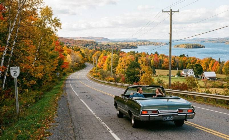
Today, trading the high-speed monotony of the 401 for the slow, nostalgic charm of County Road 2 is an unforgettable travel experience. This 3,000-word travel guide takes you on a step-by-step journey across Eastern Ontario—from the historic gateway of Kingston to the Quebec border—highlighting hidden gems, living history museums, vintage roadside architecture, and stunning river views.
The Ultimate Eastern Ontario Highway 2 Route Map
The Birthplace of the Highway – Kingston to Gananoque
Our nostalgic journey begins in Kingston, Road Trip, famously nicknamed the “Limestone City” due to its stunning 19th-century heritage buildings constructed from local stone. Kingston wasn’t just a stop along Highway 2; it was a primary hub for early Canadian transit, serving as a vital deep-water port, a military stronghold, and briefly, the first capital of United Canada.
Exploring the Limestone Core of Kingston
Before setting your odometer to zero, take a morning to wander through downtown Kingston. The old alignment of Highway 2 guides you directly past Kingston City Hall, an architectural masterpiece built in 1844. Just across the street, the Kingston Confederation Basin offers pristine views of Lake Ontario meeting the mouth of the Cataraqui River.
If you are a history enthusiast, two sites are non-negotiable before leaving town:
Fort Henry National Historic Site: Perched high on Point Henry, this massive 19th-century British military fortress guards the entrance to the Rideau Canal and the St. Lawrence River. Stepping inside feels like entering the 1860s, complete with costumed interpreters and live cannon demonstrations.
Bellevue House National Historic Site: The former home of Canada’s first prime minister, Sir John A. Macdonald, which offers an immersive look at the complex political history of early Canada.
Leaving the City Behind
Departing Kingston eastward, you will cross the LaSalle Causeway and transition onto what is now designated as Frontenac County Road 2. Almost immediately, the urban scenery softens into rolling countryside, framing glimpses of the shimmering St. Lawrence River on your right.
The drive toward Gananoque is characterized by gentle sweeping curves, mature overhanging trees, and limestone farmhouses that have stood watch over this road for over two centuries. Keep your eyes peeled for early 20th-century stone mileage markers and remnants of the old “Heritage Highway” signs that once welcomed road trippers from across North America.
Into the Heart of the 1000 Islands – Gananoque to Brockville
As you enter the boundaries of Leeds and Grenville, you arrive in Gananoque, the self-proclaimed gateway to the 1000 Islands. Interestingly, Gananoque is one of the only places in Ontario where a tiny 4.4-kilometer stretch of the road still holds its official provincial “King’s Highway 2” status.
Hidden Gems in Gananoque
Gananoque maintains a beautifully preserved red-brick industrial core, a legacy of its water-powered manufacturing boom in the late 1800s. It is the perfect spot to park the car, grab a locally roasted coffee, and explore.
The 1000 Islands Playhouse: Known as “Canada’s dockside theatre,” this vibrant venue is housed in an early 20th-century canoe club building right on the water’s edge.
Gananoque Boat Line: If you want to experience the river firsthand, hop on a classic cruise to see the legendary Boldt Castle and the tightly clustered islands that define this archipelago.
The Scenic Alternate: Thousand Islands Parkway
Just east of Gananoque, the old Highway 2 corridor splits. While the original inland route continues as a quiet county road, motorists looking for peak nostalgia should veer right onto the Thousand Islands Parkway.
Completed in the late 1930s as a scenic divided “sceneway,” this 40-kilometer stretch hugs the river bank tightly, offering unobstructed waterfront views, rocky granite cutouts characteristic of the Canadian Shield, and direct access to Landon Bay, a spectacular lookout point managed by Parks Canada.
Brockville: The City of the First Railway Tunnel
The Parkway merges back into the main line of historic Highway 2 just west of Brockville, a city overflowing with Victorian-era wealth and maritime history. Brockville was named after Major-General Sir Isaac Brock, the heroic British commander of the War of 1812.
Don’t Miss This Roadside Stop: Brockville is home to Canada’s First Railway Tunnel, completed in 1860. Running directly beneath the city’s downtown core, the tunnel has been meticulously restored with a state-of-the-art light and sound show. Walking its half-kilometer length is a sensory journey into the dawn of the Canadian industrial age.
Before leaving Brockville, drive down to Blockhouse Island to admire the vintage Golden Hawk Sabre Jet, a 1950s military fighter plane mounted permanently over the harbor as a tribute to Canada’s aviation history.
Fortresses and Rebellion – Prescott to Morrisburg
Continuing east from Brockville, Highway 2 passes through a landscape heavily shaped by military conflict and cross-border tension with the United States. The proximity of New York State, visible just across the narrow river channel, made this stretch of road a flashpoint during the 19th century.
Prescott and the War of 1812
Within twenty minutes of leaving Brockville, you will enter the historic town of Prescott. Prescott was a crucial transshipment point where large river boats exchanged goods with smaller lake vessels. To protect this vital economic choke point, the British military constructed Fort Wellington.
Visitors to Fort Wellington can explore a massive wooden blockhouse, crawl inside an underground counterscarp gallery, and view the preserved remains of a gunboat recovered from the St. Lawrence River.
The Battle of the Windmill
Two kilometers east of Prescott, a lonely stone structure rises above the riverbank at Windmill Point. This is the Battle of the Windmill National Historic Site. In November 1838, a band of American hunters and radical Canadian reformers launched an invasion across the river, seizing this sturdy stone windmill to use as a fortress.
The resulting battle raged for several days before British forces and local militia suppressed the rebellion. Today, the windmill stands as a historic lighthouse, offering panoramic views of the river and detailed exhibits regarding the uprising.
The Legend of the Blue Church
As you drive through the rural stretches between Prescott and Cardinal, keep an eye out for a small, picturesque wooden structure known simply as The Blue Church. Originally built by United Empire Loyalists in 1790, the current building dates to 1845. Its surrounding cemetery is one of the oldest European burial grounds in the province and serves as the final resting place for Barbara Heck, the revered founder of Methodism in North America.
The Lost Villages and Living History – Morrisburg to Long Sault
The stretch of Highway 2 between Morrisburg and Cornwall holds a profound, bittersweet historical narrative. In the mid-1950s, the construction of the massive St. Lawrence Seaway and Power Project forever altered this landscape. To make way for the massive flooding required to create Lake St. Lawrence, entire communities were completely submerged.
The Submerged History of the “Lost Villages”
A total of nine historic communities—including Aultsville, Dickinson’s Landing, and Farran’s Point—were erased from the map. Over six thousand residents were displaced, houses were moved on flatbed trailers, and old sections of Highway 2 vanished beneath the rising waters.
To preserve the heritage that was nearly lost to progress, Ontario created two remarkable engineering and historical monuments along the new path of Highway 2:
Upper Canada Village (Morrisburg)
Located just outside Morrisburg, Upper Canada Village is one of Canada’s premier living history museums. When the flooding was announced, dozens of heritage buildings from the doomed villages were carefully dismantled or relocated here.
Today, the village operates as a fully functioning 1860s rural community. You can chat with a traditional blacksmith, watch a water-powered wool mill spin fabric, and ride in a horse-drawn carryall along dirt roads. It is a brilliant, tactile way to understand what life along the old highway corridor was like before the age of the automobile.
The Long Sault Parkway
Perhaps the most spectacular driving segment of the entire road trip is the Long Sault Parkway. This eleven-kilometer loop branches off Highway 2 and connects a chain of eleven islands floating in the St. Lawrence River.
Remarkably, these islands are actually the original hilltops of the fertile farmland that was flooded in 1958. Driving this route feels like skim-coating across the water, with public beaches, campgrounds, and boat launches dotting the route.
The Industrial Edge and the Borderlands – Cornwall to Lancaster
Exiting the Long Sault Parkway, Highway 2 leads you into Cornwall, the easternmost city in Ontario and one of the oldest permanent settlements in Canada.
Cornwall’s Waterfront Evolution
For generations, Cornwall was defined by its booming cotton mills, paper plants, and heavy manufacturing, fueled by the cheap hydroelectric power generated by the nearby Moses-Saunders Power Dam. While the city has transitioned into a modern logistics and service hub, its connection to the river remains dominant.
Drive along Water Street, which follows the original path of Highway 2 and runs parallel to the historic Cornwall Canal. The waterfront features extensive parks and the Cornwall Community Museum, housed in an 1840 stone home built by a Loyalist family.
The French-Canadian Influence
As you continue eastward from Cornwall through Glen Walter and Summerstown, you will notice a distinct cultural shift. The architecture transitions, bilingual road signs appear, and the local accent takes on a beautiful French-Canadian cadence. This region of Stormont, Dundas, and Glengarry has maintained deep ties to neighboring Quebec for generations.
The Grand Finale: Lancaster and the Border
Our road trip reaches its final destination in Lancaster, a charming town settled by Scottish immigrants in the late 18th century. Here, the historic alignment of Highway 2 reaches the Ontario-Quebec provincial boundary, seamlessly transitioning into Quebec Route 338 as it heads toward Montreal.
Before you turn around or jump back onto the 401 for a quick ride home, take a moment to stop at Glengarry Park on the shores of Lake St. Francis. It is a peaceful spot to skip a few stones across the water, look back westward along the shoreline, and contemplate the incredible layers of Canadian history built along the edges of King’s Highway 2.
Practical Road Trip Planning & Travel Tips
To maximize your experience driving this historic route, keep these logistical details in mind:
Optimal Travel Window
The best time to drive this route is from late May through October. During these months, all living history sites, boat cruises, and roadside seasonal food stands are operating at full capacity. Autumn is particularly stunning, as the dense maple canopies overhanging County Road 2 turn vibrant shades of orange and crimson.
Driving Logistics & Speed Comparison
The Highway 401 Route: Kingston to Lancaster takes roughly 90 minutes at a continuous speed limit of 100 km/h.
The Historic Highway 2 Route: Expect to spend 4 to 6 hours minimum. The speed limit fluctuates between 50 km/h through small town main streets and 80 km/h along rural stretches.
Recommended Roadside Dining
Skip the commercial fast-food plazas on the 401 and try these local staples located right on Highway 2:
Katarina’s Coffee Shop (Prescott): Celebrated by road trippers for its exceptional scratch-made pastries, full breakfast plates, and welcoming patio.
The Sheep’s Head Bistro (Glen Walter): A fantastic waterfront dining option just east of Cornwall, known for its fresh seafood and creative seasonal menus.
Nostalgic Architecture: Preserving the Golden Age of the Road Trip
One of the greatest joys of exploring King’s Highway 2 is observing the physical architecture of early Canadian automobile tourism. Long before international hotel conglomerates dominated the travel industry, the family road trip spawned a completely unique landscape of roadside commerce.
The Rise of the Tourist Cabin and Motor Court
In the 1930s and 1940s, as vehicles became more reliable, families began exploring the province in record numbers. Along Highway 2, farmers and entrepreneurs began building clusters of small, identical wooden structures known as tourist cabins. These evolved into the classic motor courts or motels of the 1950s—characterized by their neon signs, L-shaped layouts, and individual parking spots right outside each bedroom door.
As you drive through communities like Summer stown, Brighton, and the outskirts of Brockville, you can still spot these vintage motels. While some have been converted into long-term residences or private apartments, their architectural silhouettes remain unmistakably tied to the mid-century golden age of independent travel.
Preserving a Slower Pace of Travel
Choosing to drive the historic King’s Highway 2 is an intentional act of slow travel. It forces you to stop at pedestrian crosswalks, look at the architectural details of local brickwork, read the weathered plaques detailing regional skirmishes, and buy your apples directly from a roadside farm orchard.
The next time you find yourself speeding down the multi-lane blacktop of Highway 401, watching the exit signs blur past, consider taking the off-ramp. Step back in time, adjust your speed, and let the historic curves of Highway 2 guide you across the rich cultural landscape of Eastern Ontario.